We love all of the Pilbara region of Western Australia and different parts have different treasures but the jewel of the region has to to be Karajini National Park. We’ve visited the park several times before but it’s a place you can visit time and time again to enjoy the wonderful country, the colours, the mountains and the deep gorges.
This is an ancient land; mountain ranges have weathered down and while they are still called mountains, Mount Bruce, Mount Sheila, Mount Nameless and Mount Meharry, in other younger countries they would simply be called hills.
Precipitation doesn’t occur very often but when it rains it pours. It’s a dry country now but there are still permanent water sources and the flat red earth is cut by deep gorges. From the top you can peer down into deep canyons to see waterfalls and rock pools. Several walking trails take you down into subterranean gorges. Our last visit was nearly six years ago and while Paul still tackled some of the difficult trails on this trip I lowered the bar and settled for moderate walks (up to class 4).
The first gorge we visited this trip was Kalamina Gorge. It’s one of the most accessible gorges and while not as dramatic as some we think it is possibly the prettiest gorge with some lovely little falls and reflecting rock pools. It’s in the middle of the park and on previous visits it’s been very quiet but word of its charm seems to have got out as the car park was nearly full when we arrived. We still managed to have plenty of quiet times to enjoy the beauty as most other visitors walked the gorge, possibly had a dip, and then left.
From Kalamina Gorge we travelled to our first camp at the national park campground near Dales Gorge where we stayed for three nights. The easiest entry into Dales Gorge is via a steep staircase down to Fortescue Falls. There were quite a few swimmers in the pool below the falls.
From Fortescue Falls it is a short further walk to the idyllic Fern Pool.
Fern Pool, Dales Gorge, Karajini National Park, WA
The other entry into the gorge is via a steep path including a short ladder near Circular Pool. On our first evening we took a very pleasant walk along the rim. The late afternoon light displayed the beauty of the country and the wildflowers were a delight.
Circular Pool was closed due to a recent rock slide but the path through the gorge was still open and was a great walk on the next day.
About 50 km west of Dales Gorge several gorges meet and provide some of the most spectacular scenery in the park. We moved camp to best appreciate these places and spent the next three nights at the Karijini Eco Retreat. We stopped to enjoy the view at the lookout over Joffre Gorge and Paul returned there for some pre sunrise photography the next morning,
Joffre Gorge, Karijini NP, WA
The landscape and vegetation in this region is amazing and we never tire of it, especially when the sun is just rising or getting low and providing extra drama.
Weano Gorge with Handrail Pool at the end of the accessible area provides amazing rich colours
Another amazing gorge to visit is Hancock Gorge and at the end of a very tricky walk you reach the magical Kermits Pool where light bounces off red and gold walls to create magical waterfalls.
Before leaving Karijini we had one more stop. Hammersley Gorge is on the western edge of the park and has some amazing rock formations we have photographed in the past, This time we hoped to see the Spa Pool, a spot we had missed on previous visits. We reached the bottom of the gorge not long past sunrise and Paul began the scramble up the gorge toward the spa. I decided it was too tricky for me and picked my way up the rocky sides to a spot above the spa. From there I could see we had picked the wrong time of the day to visit as it was half in deep shade and half in strong sun.
Paul had a far more difficult trek to reach a spot where he made the same conclusion. Guess you can’t win them all. Anyway Paul managed a lovely shot of one of the small water falls and I enjoyed the amazing curves in the rocks.
If you have never been to Karijini you should put it on your bucket list and if you’ve only been once or twice or for just a short time it is certainly worth a return visit.
Malawi is a relatively small country, roughly 900km long and between 80km and 150km wide, in comparison with the others we have visited so far. Almost one fifth of the country is covered by the inland sea, Lake Malawi is the focal point for most visitors and there are also highlands in the north and the south which we want to visit. As well as Zambia, the country also has borders with Tanzania and Mozambique. Its a friendly, inexpensive and easy country to travel in so we plan to stay about five or six weeks.
We cross into Malawi from Zambia in the far north west at the tiny border post of Chitipa. The road from Zambia was very rough and slow for the last part of our trip and it is dark by the time we have cleared the border so we’re happy to find a guest house and take a room for the night. It’s basic but clean and has an ensuite and secure parking, pretty good for 5,000 Malawi Kwacha which is about $9.00 Aussie dollars.
In the morning we have an easy drive down from the high country to the town of Karonga on the shores of Lake Malawi. It’s quite a big town and has a bustling and colourful market where we can stock up on wonderful fresh produce.
Karonga Market, Malawi
Karonga Market, Malawi
Karonga Market, Malawi
Karonga Market, Malawi
Karonga Market, Malawi
Karonga Market, Malawi
Karonga Market, Malawi
Karonga Market, Malawi
Alfred and his wife Elizabeth and their three sons and three daughters have built and run Thunduzi Camp on the shores of Lake Malawi in the tiny settlement of Chilumba. The camp is very quiet but the attached bar and restaurant do a good trade and Alfred has plans to make more improvements to the camping and to add additional accommodation. It’s a very pleasant spot and we need a break from travelling so we are soon set up and settled in for the next couple of weeks. Unfortunately I have a bit of a virus and need to spend a fair bit of the first week sleeping and then slowly recuperating but Paul easily fills in his time with his photos and also taking a walk with one of Alfred’s sons through the village to visit the local ‘brewery’ and to meet some of the local people and sample some street food.
Thunduzi Camp, Malawi
Thunduzi Camp, Malawi
Chilumba Brewery, Malawi
Street Food, Chilumba, Malawi
Chilumba, Malawi
Chilumba, Malawi
Fishermen Mending the Nets, Chilumba, Malawi
Checking the Catch, Chilumba, Malawi
During the second week, when I am mostly recovered, we take a drive back up into the high country to the old mission station and colonial town of Livingstonia. To reach it we have a short drive down the main road next to the lake then a steep climb up an unmaintained dirt track. The last ten kilometres takes an hour and we are very glad we didn’t bring the trailer. The town was built on the edge of the plateau west of the lake by Scottish missionaries in the 1890’s because too many people were dying of malaria at the original mission settlements at the lower altitudes beside Lake Malawi. Livingstonia is picturesque with solid stone buildings spread along tree-lined streets and wonderful mountain views in all directions. It is also much cooler up here and it is pleasant to spend a couple of nights tucked under a cosy doona at the Lukwe Permaculture Camp. Paul walks through the permaculture gardens to the nearby Manchewe Falls but I’m content to sit and enjoy the views and complete my recuperation. Or maybe I was just feeling lazy.
Manchewe Waterfall, Livingstonia, Malawi
Relaxing on the Deck, Lukwe Camp, Livingstonia
After another couple of nights back at Thunduzi its time to move on and we head toward the Nyika Plateau National Park. We stop overnight in Rumphi on our way and find a place to leave our trailer as we are in for another steep drive. While Livingstonia, at 1200m above sea level, is more than 900 metres above the lake, Nyika Plateau is over 2,500m above sea level. Nights are much cooler, with a light dusting of frost on the grass in the mornings, so we need to dig out our cold weather clothing and add a down sleeping bag on top of the doona. Its worth it though with wonderful views and plenty of chances to spot wildlife. At this altitude there are not a lot of native trees, just the remains of a failed pine plantation in one section, and the hills are covered in rolling grassland punctuated by rocky outcrops. There are zebras, reedbucks, eland and other antelope scattered around the hills and pretty bushbucks hang around the camp ground and the lake by the lodge. Leopard have been sighted recently not too far from the lodge but although we try hard we aren’t lucky enough to see them. There are also elephant and buffalo in the park but at this time of the year they head to lower altitudes in a corner of the park which isn’t accessible by car.
Reed Buck, Nyika Plateau, Malawi
Nyika Plateau, Malawi
Roan Antelope, Nyika Plateau, Malawi
After two and a half days spent driving through the glorious country and two nights huddling around the fire while we gaze at the stars we head back to Rumphi for another night and then on to Vwaza Marsh Wildlife Reserve. We are still well above the level of Lake Malawi and the temperatures are mild but the Wildlife Reserve is covered by woodland along with a large lake and river along one edge and a marsh and wetlands forming at the end of the river. The campground is set on the edge of the lake and although the water level is low there is still plenty left for hundreds, or probably thousands, of hippos. We had planned on camping but by some curious vagary in the pricing it is cheaper to stay in one of the pleasant huts which are managed by the local community than it is to camp, the pricing of which is set by the national parks body. We go for a short drive around the edge of the lake and along one of the bush tracks on our first day and plan to go for longer drives later but sitting on the verandah of our hut we gaze out at a passing parade of impala, kudu, puku and elephant as well as the hundreds of hippos at this end of the lake so we pass the next couple of days lazily. A couple of herds of elephant with lots of tiny babies come down to drink not far from the camp and one group walk right through the middle of it, wonderful to experience. As well as being almost submerged in water the hippos spend quite a lot of time out of the water during the day, probably because the temperatures are mild and they need to warm up a little. It gives us a great chance to see the numerous baby hippos and the adults lazing around the shores of the lake. They lie around for hours at a time and then suddenly, for no reason we can see, the whole herd ups and charges into the water. Soon afterwards they start straggling back out of the water. Very funny to watch.
Elephants in the Camp, Vwaza Marsh, Malawi
Hippos, Vwaza March, Malawi
Elephants in the Camp, Vwaza Marsh, Malawi
Hippos, Vwaza Marsh, Malawi
Elephants near the Camp, Vwaza Marsh, Malawi
Our next destination is Mzuzu, the largest town in northern Malawi. We found a great range of fresh fruit and vegetables in Karonga but we haven’t seen a supermarket since we left Lusaka in Zambia so supplies are getting low and we are looking forward to stocking up. We also need to extend our entry permit and we find the government offices right across the road from another colourful market, much more fun visiting the market than lining up in the immigration office. The last service of the car was in Cape Town so that is due as well and we find a very pleasant camp just out of town to spend a couple of nights while we do our chores. The owners of the Maconda Camp, Luca and Cecilia, are Italian and, as well as the small campground and some other accommodation, they run a well frequented restaurant. The food is delicious, especially the pasta and pizza, so we skip cooking and dine in style for the two nights we are here.
Mzuzu Market, Malawi
Mzuzu Market, Malawi
Mzuzu Market, Malawi
Mzuzu Market, Malawi
Luca recommends another camp further south along the lake and so we stop in at Kachere Kastle in Chincheche. Its an amazing place built over the past seven years by Russell and Kate, originally from England but now enjoying living in Malawi. They have paid enormous attention to detail and did all the plumbing and electrical work themselves to ensure quality control, an amazing effort. Paul starts taking photos and drone footage of the place and Russell and Kate are very impressed by the results so we end up trading a video and still photographs for our accommodation which included a very comfortable room plus dinner on the last of our 8 night stay.
Kachere Kastle, Malawi
Kachere Kastle, Malawi
Kachere Kastle, Malawi
Kachere Kastle, Malawi
Kachere Kastle, Malawi
We’ve been in Malawi for nearly a month by now and we’re still in the northern section so we need to hurry ourselves up as there are some spots in the south we don’t want to miss. On a recommendation from Luca in Mzuzu, Mua Mission in central Malawi is our next destination. This mission was built at the beginning of the 20th century and has some wonderful old buildings and a large church but our interest is in museum and cultural centre which houses a huge collection of Gule Wamkulu masks, drums and other accoutrements and a series of murals providing huge amounts of information about the daily life and the traditions of the three main cultural groups in the area. These masks are used in “the Great Dance of Malawi” which is now on the UNESCO Intangible Cultural Heritage register. The dance is mainly performed at funerals and memorial services but also at initiations and other celebrations. The masks worn by the dancers on such performances are believed to capture the soul or spirit of the deceased that brings renewed life. The purpose of the dance is said to be a way of communicating messages of the ancestors to the villagers and making possible continued harvests and continued life. Father Claude Boucher, originally from Montreal, has been in Malawi for more than 50 years and has collected hundreds of masks and documented the characters and their stories. Its late afternoon when we arrive so we spend the night in a chalet and plan to spend the morning visiting the cultural centre and gallery and be on our way before lunchtime. Father Boucher invites us to watch a performance which has been arranged for a group and it should commence mid-morning. The group are late arriving, we’ve already had our lunch and the elaborately costumed performers have also had to wait but we are extremely pleased to have this opportunity as we are enchanted by the performance. The costumes, the dancing, the singing, the drumming and particularly the masked characters combine to tell a story and to pass on a message to the audience.
Wood Carving, Mua Mission, Malawi
Wood Carvings, Mua Mission, Malawi
The Great Dance, Mua Mission, Malawi
Liwonde National Park on the Shire River is our next destination. It is in southern Malawi so we’ve left the lake behind us now. It’s late when we arrive at our campground, getting dark before we are even set up so we have a slow start in the morning then drive to the entrance of the national park. The fees are double the amount we were expecting and we are not sure that we will see much wildlife in the half a day we would be in the park so we decide to give it a miss and return to camp. The camp ground is hot, dry and dusty but the baobabs at sunset make our two nights here almost worthwhile.
Bushmans Baobabs, Liwonde NP, Malawi
We need to get out of the dust and the heat for a couple of days so we take a detour from our southerly course and drive up to the Zomba Plateau. The trout farm at the top of the small plateau has a grassy area for camping and it’s a lovely spot to sit for a couple of days. Large trees provide shade for the trailer and car but there are plenty of open patches so our solar panels can keep the batteries topped up. Water from the adjacent creek is channelled to the hatchery nearby and we scoop it out by the bucketful to drink and to fill our water tank. Its the clearest and best tasting water we have had for ages. Most has been bore water which is ok for drinking but contains minerals which coat the kettle and thermos, and the ‘treated’ water available in the towns contains chlorine and other chemicals to make it safe to drink. The climate on the plateau is perfect for berry and avocado growing and we feast on strawberries, raspberries and avocados which we buy from the side of the road on our way up. We aim to buy more on our way down. The only thing we are lacking on this trout farm is the trout to eat as they only have the very small fingerlings, maybe they will be bigger in a year.
We could easily linger longer at the trout farm as there are lots of walks and waterfalls in the area but we need to keep moving so we head to Blantyre, the largest city in the south of Malawi and the commercial and industrial capital of the country. We have a couple of places to visit out of Blantyre but it is the hub of the south so we find a secure camp to drop off the trailer and head straight on to Majete National Park. This is further down the Shire River and we stop in a private lodge and campground very near the entrance. Our site is fabulous, right next to a lovely swimming pool which is surrounded by a deck overlooking the river. We had planned to stay two nights but we arrived late so to allow ourselves a full day in the park and a day enjoying the camp we stay a third night. On the day we spend in the park we have a very early start and leave camp before breakfast so we can be at the gate when it opens at 6.00am. There are a network of tracks in the park and we easily fill in the whole day and stay until the late afternoon. The tracks take us along the picturesque Shire River and to two very popular waterholes. This park has probably the highest concentration of animals in Malawi and we see plenty; lots of elephants and hippos, a good variety of buck including a beautiful sable antelope, buffalo, wildebeest and zebra, but unfortunately no lions or leopards.
Sable Antelope, Majete NP, Malawi
Elephants, Majete NP, Malawi
Warthogs, Majete NP, Malawi
Shire River, Majete NP, Malawi
Chacma Baboon, Majete NP, Malawi
From Majete we return to Blantyre, replenish the small fridge in the car from the large fridge in the trailer, and drive out to Mt Mulanje. The mountain is a huge mass of granite rising 3,000m above the surrounding plain and it is a very popular destination for hikers. We’re not going to tackle any of the multi day hikes but plan to walk to one of the waterfalls. The first place inside the park we visit to find a place to stay has a group of fifty coming in later that day and all the chalets and rooms are booked so although we could camp we decide to continue looking and the next place is ideal. It is in the lower section of the park but still quite elevated and the temperature has dropped accordingly. We could camp but the lodge has delightful rooms at a very reasonable price so we stay warm and comfortable and enjoy a bit of luxury. Numerous locals offer to guide us to the falls so we agree on a price and set out in the morning. We are able to take the car a fair distance up the track so our walk is halved. Its not a difficult or overly steep walk but we have not done any walking for ages so it is good to stretch our legs and get a bit of exercise as we walk through the bush. It is the dry season so the falls are not roaring but they are still impressive and Paul clambers around the rocks to get different vantage points for his photos. We finish off our visit to Mulanje with a pizza in the town and head back to Blantyre.
Waterfall, Mt Mulanje NP, Malawi
Path to the Waterfall, Mt Mulanje NP, Malawi
As we are approaching Blantyre and the camp where we have left our trailer Paul starts feeling cold although I think it is still quite a mild day. By the time we are in the camping area he is feeling worse and starts shivering uncontrollably. Its an easy self diagnosis of malaria and we hurriedly consider the options. When we were in Mozambique we bought some malaria curative tablets which, if taken promptly, will greatly lessen the severity and length of an attack so Paul takes the first dose while I am checking out the internet for more information on malaria and for the location of doctors or hospitals nearby. As we are in a large city there are several options and I map out a route to a private hospital where I hope we can get quick attention. The curative tablets sure work fast as we are still on our way when Paul stops shaking and doesn’t feel as terrible. Now that we know the tablets are working and a doctor could do little else to help we change our plans and look for a guest house, Paul may be feeling a little better but camping is certainly not an option. I pick one from the guide book which looks easy to get to and drive there to check it out. The room looks ok so I help Paul inside and pile blankets on top of him and he basically sleeps for the next two days. His fever drops as he continues to take the tablets, we are certainly grateful to Barbara and James in Mozambique for their advice about carrying the malaria curative with us.
When I checked out the room I didn’t check the bed and unfortunately it is very hard so as soon as Paul is up and eating again we decide he is well enough for us to move on provided I do the driving and we stay in rooms for the next couple of nights. We finally collect the trailer, very appreciative of being able to leave it there safely and to have had the use of power to keep the fridge running and they don’t even want to charge us anything … Malawi is certainly a friendly and hospitable place. We leave a donation and make our way north to a little place called Dedza. Its on the tourist route because they have a very good pottery and a range of accommodation. We enjoy a very comfortable bed in a delightful room with dinner in the restaurant and a visit to the pottery in the morning. A bit of pampering is certainly a good idea right now.
It is time to leave Malawi so in the morning we take the shortest and easiest route to the border. It bypasses the capital of Lilongwe and we arrive at the border with Zambia by mid afternoon. Its been a delightful country to visit, (its a pity malaria is so prevalent,) the people are friendly and welcoming, accommodation and national park fees are cheaper the surrounding countries, and it has been far quieter and less crowded. The lake is very impressive and the highland areas provided a welcome change in both the geography and the climate, it is certainly a country we would recommend to other travellers.
We haven’t written anything about our time in Zambia yet and we have come to the end of our second stint in the country having spent a month in Malawi in the middle. We are in Zimbabwe now for about three weeks and we don’t expect to have much time with access to the Internet so it’s high time we caught up on our blog posts.
After leaving Namibia through the busy border post at Katima Malilo, which took us about two hours and where we had someone scrape past the side of our trailer with their car and bending a bolt in the process which means we can’t use one of the support legs any more, we tracked north alongside the Zambezi River. The nature of the villages and roadside stalls in Zambia was noticeably different to Nambia.
We stopped for five nights at Ngonye River Camp. It’s a lovely quiet spot with a grassy camp site under shady trees on a slight slope above the Zambezi River. Jack and his wife who own the property do a lot of work with church missionaries and they have built a couple of chalets and a camp site to generate some income to fund their work. I flew the drone out over the river from our camp and captured these images.
While we were there we visited the little nature park up the road and paid a guide (good idea!) and walked out to the Ngonye Falls. Impressive! The series of falls are over a kilometre wide and you have to walk to a few spots to get a view of them. I was able to fly the drone and get some video as well as some still shots. The aerial perspective really showed off the extent of the falls. Our guide pointed out one of the falls and told us that it was called Jo’burg Falls because a local fisherman caught fish there to feed his family instead of traveling to Johannesburg in South Africa for work. Good plan!
We asked Jack about the beautiful and large tree trunks we were seeing stockpiled in various places along the road. He told us that the Chinese are paying the villagers $3 for each Rosewood Tree and that they are quickly disappearing from the countryside.
When we left there we drove north, still alongside the Zambezi River floodplain. We eventually turned east towards Kafue National Park, although we tried to go north from Mongu towards the source of the Zambezi River in the far north west corner of Zambia but ran out of useful road not far north of Mongu.
We settled for staying two nights at Ikithe Resort on Lake Makakaela about thirty kilometres north of Mongu. It’s a very pretty place at sunset and sunrise when there is very little wind and the glassy lake reflects the gorgeous colours while fishermen glide across the water, with barely a ripple, in their dugout canoes. While we were there we met a couple from Columbia in a Landcruiser doing a loop from Nairobi down through Zambia to Namibia then back up through Malawi and Tanzania to Nairobi again. They are avid bird watchers and we exchanged notes on where we planned to go in Zambia.
The Zambezi river does a bit of a loop from the source out west into Angola before heading east and south back into Zambia. We will try to get to the source of the Zambezi next year when we travel across Zambia through to Angola. There are huge teak forests up there which we are keen to see. Roger and Jenni, a couple of South Africans we met in Namibia, did manage to get up to the source of the Zambezi by driving through the Liuwa Plains National Park but it was still early in the dry season and we didn’t like our chances with the trailer as it gets very boggy out there and we didn’t have any information on the crossings over the Zambezi River in that area.
We came across this cart on our way back to Mongu where we headed east on the main road to Lusaka via Kafue National Park.
We didn’t go into the park itself but drove through it on the transit road from the west. The Columbian couple stayed in Kafue and they said it was great but they didn’t see a lot of animals. After staying one night beside the river on the eastern boundary of Kafue National Park, we drove down to a small town called Ithezi Thezi on the eastern side of the big lake, also called Ithezi Thezi, that borders the Kafue National Park. We stayed five nights at Chibila, one of David Shepherd’s old camps where he used to go and paint, and we absolutely loved it!!! It was so reasonable we stayed in one of the chalets which are set amongst the boulders high above the lake. Tree hyrax run around all over the place. So peaceful! We can’t recommend it highly enough.
We had an interesting journey east across the Kafue River plains from there. The road was slow going but reasonable through numerous villages until we got to the pontoon across the Kafue River. Since the pontoon, which is only one car wide, couldn’t turn around we had to reverse the car and trailer onto it. We managed it fine but it could have been pretty tricky! Once we were on the pontoon we had to wait while a cow with a broken leg was dragged off the back of a cart onto the pontoon. After driving off the other side we had ten kilometres of very rough, but mostly dry black cotton soil which would have been impossible after any sort of rain. We reached Choma late-ish that night, found a rough and ready place for one night which I thought was probably a brothel, and then the next day we drove up the main road to Eureka camp just south of Lusaka. We were on tar but there were lots of nasty potholes, especially north of Mazabuka. It would be easy to break the car if we traveled too fast on these kinds of roads.
Lusaka is useful for shopping, otherwise I would avoid it completely. The traffic is terrible and it’s difficult to get around. We stayed at Eureka on the southern outskirts of the city (nice) and, after shopping in town, We camped at Fringilla Farm 50km north of Lusaka. Very friendly people and a good butcher there who makes biltong and boerewors as well as some home-made chilli relish! We ended up having a few beers with some of the locals at their sports club and picked up lots of tips on various destinations in Zambia.
It was a fair distance to our next destination so we broke our trip with an overnight stop at a place called Kalwa. We headed north until we reached a turnoff which took us to an old homestead which has been taken over by the local village and is now used as accommodation for the odd visitor. We camped on the front lawn and had a regular flow of the villagers walking past and kids stopping to check us out all afternoon. The evening and the night were very cool as we were still on the plateau at about 1,500 metres above sea level. As we went to sleep we could hear the villagers singing. Then incredibly, at four thirty in the morning we heard a large group chanting and singing in unison. The very loud noise got closer and closer, singing as they marched past our camp. We found out later that it was a group of youngsters getting their ‘early’ morning exercise as they learn how to be ‘Good Christian Youths’. The stamping of feet and the rhythmic bass voices and shrill ululations at that time of the night were totally unexpected and quite thrilling!
We elected not to visit many of the national parks in Zambia as they are quite expensive. Going north from Lusaka we did visit Kasanka NP though to see the Sitatunga buck which are adapted to living in marshes. They have really long feet! We stopped at Pontoon Camp for coffee and got a really good sighting of several Sitatunga around the waterhole. That was a really nice place under some huge, very shady indigenous trees. We elected to camp at the Kasanka Conservation Centre just outside the park to save a bit of money. Worked very well for us as they let you drive into the park before sunrise and come out after sunset. We did a fair bit of driving and in the north west corner we were driving on an overgrown track where the grass was quite a bit taller than the car. We navigated by looking for the most likely gap between the trees and trying to spot the shadow of the track underneath the grass. Eventually we had to backtrack when we reached a very boggy river crossing. When you get stuck in that black cotton soil you stay stuck!!
At another spot we climbed a ladder up to a viewpoint about twenty metres up a tree which looked out over the flood plains. Nearby was a spot where millions of bats can be seen at a certain time of the year … not when we were there though!
The chap looking after the Kasanka Conservation Centre turned out to be the head school teacher (three teachers in total) at the school which operates from there and caters for about one hundred children. Although it was the weekend he gave us a tour of the place which is funded by a private trust. We saw the tree seedlings which they were preparing to hand out to the nearby villages as part of a deal whereby they planted three trees for every one they cut down. In another part we saw the centre’s vegetable garden which is surrounded by an ‘elephant fence’ consisting of a series of very tall chilli bushes over a metre wide and a metre high. Apparently it works pretty well to keep elephants away from the crops around the villages. Pretty nifty we thought!
When we left Kasanka NP we were planning to camp at Lake Waka Waka and spend a day in Bangweulu national park north of there to see the Shoebill Storks. We had our doubts about driving those roads with the trailer and when we heard that Lake Waka Waka was not very inviting we decided to give both a miss.
Our next destination was Mutinondo, a private lodge which is further north and east of the main road. It’s a bit expensive but a very nice spot set high amongst the rocky inselbergs above a river which has many small waterfalls along its course as it winds its way between the hills. The camp sites don’t get much sun though so they stay quite cool. We stayed three nights and I took some shots of one waterfall and flew the drone out across the river to a group of inselbergs to the east.
The last place we stayed in Zambia was Kupishya hot springs, which is about thirty kilometres west of the main road. The camping is next to a fast flowing river and the hot springs are fantastic! Well worth it, especially in the morning when the air is cool and the steam rises off the water. We met Bob and Cheryl there, a couple of Aussies from South Australia, who have made around twenty trips to Africa and are funding the education and some medical bills for a couple of families in East Africa.
After leaving Kupishya we knew we had a big days drive to get to the Malawi border at Chitipa. We phoned a contact at the Zambian Immigration Services who confirmed that the border post would be attended that day and it would close at 5pm. The drive up the main road to Isoka went fine apart from some bad potholes, but we knew the next part would be more interesting on a gravel road running through lots of villages as it wound its way across country to Malawi. This turned out to be somewhat of an understatement as, for much of the way, the track didn’t follow any of our maps and where it got too eroded it took side trips through the middle of the nearby villages. We resorted to asking for directions at each intersection. It was slow going and as it got later we knew we weren’t going to get to the border by 5pm. We pushed on and eventually reached a few buildings on the outskirts of a village which looked vaguely official. A well-dressed chap sitting outside the first one told us that he was the resident Zambian Immigration Officer and that the border closed at 6pm. It was five thirty, so we had made it after all! The Zambian formalities were straightforward and then we drove a little further to a large old house where we found several Malawi at adjacent desks in a few of the rooms. One room was the immigration department and the other was the customs and revenue office. We got everything done except the third party insurance which we would have to get in Karonga, the next town down the road.
We got directions to a local motel which was not too far away but in the dark it was quite tricky too find. There wasn’t much open in town so we had a meal of snacks and a couple of beers. Welcome to Malawi. We were looking forward to seeing Lake Malawi the next day when we reached Karonga.
Etosha is one of Namibia’s major tourist destinations and a great place to see lots of wildlife. The park is more than 20,000 square kilometres with the huge Etosha salt pan as its heart. Bushveld, waterholes and open plains surround it. The opportunity to see Black rhinos is a major draw card but there are lots of other animals to see here as well. It’s a busy place and it is best to pre-book accommodation but by the time we work out when we were likely to arrive it is too late to book, so we’ll just have to take our chances. We reach the western gate late in the afternoon after travelling down from the Kunene River and spend the night in a camp across the road from the entrance.
We make a very early start in the morning and it is just as well as the first two camping areas we reach have no vacancies and, allowing time for stopping at waterholes, it is late afternoon by the time we reach Halali Rest Camp. All of the rest camps have a variety of accommodation as well as camping, all have a waterhole you can visit from inside the rest camp allowing you to view wildlife at any time of day or night. The main three rest camps also have swimming pools, restaurants and a shop. We would like to have had a couple of nights at Oaukeujo Camp as its waterhole is the best place to see the rhino and lots of other animals frequent it as well but it is also the most popular camp and it is fully booked.
Halali has a huge camping area and we have no problems getting a site here and we happily stay for four nights. The waterhole here is just a short walk from our camp and makes a great spot to sit with an early morning cup of tea or coffee, a late afternoon drink and nibbles, and an evening viewing when the floodlights illuminate the animals venturing in for a drink. In between we drive along the network of tracks through the bush land and along the edge of the pan and visit the waterholes either for a short period, if it is dry or there are no animals around, or for longer if there is lots of activity.
Zebra are numerous as are black faced Impala and Springbok. It’s mating season for the Impala and males spar to claim their right to be the alpha male and to chase the females, generally unsuccessfully as far as we can see. Other antelope we see include Kudu, Hartebeest, Oryx and Wildebeest. Giraffe appear behind the trees or cross the open land in their swaying gait. There are lots of elephants in the park and we see a good sized herd on our way in and also at Halali waterhole. Ostriches appear to float above the mirage on the salt pan and bob through the grassland. A couple of lionesses snooze in the long grass near a waterhole and make all the other animals nervous. We see rhino at a couple of waterholes including Halali, they look especially solid under the night light but when a family of elephants are there first they make the rhino look much smaller and he circles around warily with a couple of the female elephants watching him carefully until they allow him in to drink. Warthogs scamper through the grass with tails held high looking ridiculous as usual, and somehow appealing at the same time. If they are around there will be leopard but we’re not lucky enough to see them, they are very shy and hard to spot.
We see lots of birds as well. The Lilac Breasted Roller displays its beautiful colours perched on a branch looking for insects but when it flies a whole new set of colours is on show. Tall Secretary Birds stalk through the grass along with Bustards and Korhaans. Kingfishers and Bee-Eaters swoop and birds of prey soar above us.
Rhino at Halali Waterhole, Etosha NP
Halali Waterhole, Etosha NP
Hartebeest, Etosha NP
Guinea Fowl, Rietfontein, Etosha NP
Elephant, Halali, Etosha NP
Elephant, Halali, Etosha NP
Halali Waterhole, Etosha NP
Vulture, Etosha NP
Springbok, Etosha NP
Kudu at Halali, Etosha NP
Rhino at Halali, Etosha NP
Oryx, Rietfontein, Etosha NP
Lion, Rietfontein, Etosha NP
Zebra fighting, Etosha NP
Rhino, Etosha NP
Black-backed Jackal, Etosha NP
Impala drinking at Halali, Etosha NP
Oryx, Etosha NP
Kori Bustard, Etosha NP
Lilac-breasted Roller, Etosha NP
Giraffe, Etosha NP
After our four nights at Halali it’s time to head out the eastern gate. There’s another rest camp here, Namutomi, but we’ve been told it’s full. We call into the reception there on the off chance and talk our way into a site for the night. It’s a lot smaller and the grass and trees are very welcome. There is an old German Fort here and it’s worth a look even though it isn’t being well used at present and the accommodation, restaurant and bar which used to be in the fort are closed and dilapidated. It seems you can no longer sleep in the old soldiers quarters as you used to be able to do. The waterhole is being revamped and the only ‘cat’ we see here is the mechanical kind which is enlarging the hole. Instead of spending sunset at the waterhole we return to our pleasant campsite. Neighbouring campers, Roger and Jenny, join us and our last night in the park is spent sitting around our campfire chatting. This has certainly been a great place to visit.
Two weeks after we arrive in South Africa we are delighted to participate in a surprise celebration for the 90th birthday of Paul’s Mum, Eileen. Her actual birthday was a couple of months ago but her granddaughters Kate and Gemma who are organising the event delayed the date until Paul could be here. Nobody has let slip anything about the party to Eileen and there are a more surprises in store for her. Paul’s son Sean, daughter Caitlin and her husband Kevin have flown over from Australia and she has no idea they are coming. Kate has come up from Cape Town and Eileen’s daughter Sarah and grandsons Dylan and Keegan have travelled from Durban, again all without Eileen’s knowledge. Other family and friends from around Johannesburg are also assembling for the event. As a final surprise, two days after the party we are taking her on a six day trip to Kruger National Park and Sean, Caitlin and Kevin are coming along as well.
Late Saturday morning all the guests are assembled at the venue, a pool-side “lapa” (thatched shelter without walls) belonging to the daughter of Eileen’s best friend Jean. Eileen thinks she is coming to collect Jean to go out for lunch. Kate and Gemma have done a fabulous job preparing the area and decorating the lapa with roses and balloons. Tables have been laid with white tablecloths, there are plenty of chairs and shade to relax in, and all the food has been organised so we all enjoy the glorious day as we wait for the guest of honour. When she arrives Eileen is quite overcome by surprise and delighted by the gathering. All in all it is a wonderful afternoon with lots of conversations and laughter, good food and drink, short speeches and the obligatory photos.
Speech Time
Happy Birthday Eileen
Family Portrait
6.00 am Monday morning we arrive to collect Eileen for the long drive to Kruger. By the time we have loaded the meat out of the freezer, fitted all the last minute bits and pieces in and double checked the driving directions it is after 6.30 and the peak hour traffic is well underway. We hit a couple of slow patches of heavy traffic and even though we are travelling on freeways and against the majority of the traffic for most of the time it is still a couple of hours before we have managed to escape from the greater Johannesburg area.
We would prefer to avoid freeways and stick to quieter country roads (and avoid the tolls) but with [such] a long way to go we need to use them for a good part of the trip. Caitlin, Kevin and Sean trail our much slower Landcruiser in their rental car. They could cut quite a bit of time off the trip if they didn’t have to slow down as we trudge up hills and we never approach the speed limit of 120 kph. By late morning we have a good part of the distance covered and it is finally time to leave the freeway. Paul has planned a route to take advantage of the views available as we descend from the highveld, the central plateau covering much of South Africa, to the middleveld and then down to the lowveld. The passes are all named and he has chosen the picturesque Long Tom pass for our descent to the middleveld. We stop at the top to admire the views, try to decipher the history on the plaques (it is written in Afrikaans), buy souvenirs and have picnic lunch. The British used a Long Tom cannon, possibly more than one, to control the pass during the last Boer War and this was the last site it was used. Continuing our journey to the lowveld we pass through towns and villages, all much bigger than the last time Paul visited this area and finally we arrive at Orpen Gate at around 4pm, our point of entry into Kruger.
Kruger National Park is in the north east corner of South Africa with the Lebombo Ranges in Mozambique running north south along the eastern border and reaching Zimbabwe and the Gonarezhou National Park in the far north. It covers 20,000 sq km and stretches 444 km from Malalene Gate in the south through to Parfuri Gate in the north. There are seven other entry points within South Africa and two from Mozambique. The southern section has the most visitors and we are avoiding it this trip with our accomodation booked in the central area of the park.
Our first night is at Tamboti Tented Camp, only a few kilometres from Orpen. Here we stay in safari tents with shared bathroom and kitchen facilities. The tents all have two beds, power, a fridge, a secure food storage locker, a braai (barbecue), and a verandah. By the time we have unloaded everything from the eskys and got ourselves organised on Eileen’s verandah we are just in time to watch the sunset over the dry river bed in front of us while we enjoy a gin and tonic (or beer or wine as preferred). Baboons call from a large tree opposite and we wonder what other wildlife is nearby. The camp is surrounded by an electric fence which runs in front of us alongside the river bed but as we are elevated it protects us without interrupting our view. After a delicious braai and a relaxed evening chatting under the starry sky we head for bed, weary after the long drive and looking forward to the days ahead.
During the night people in our group hear lions roar, hyenas cackle and baboons chatter nearby and other campers report hearing a leopard growl but I managed to sleep through it all. The baboons provide plenty of interest as we share breakfast on the verandah. The tree opposite is home to a large troop and after seeing just a few on outer branches initially we see more and more appear and descend to the river bed. Eventually there are about 30 to 40 on the ground. Youngsters play and others enjoy the sunshine before they all slowly make their way along the sand and out of our sight to spend their day before they will no doubt return to this tree for the night.
Finally we are also ready to start our day’s journey and leave Tamboti to head toward Shimuwini where we will be staying for the next four nights. The speed limit in the park is 50 on bitumen roads and 40 on dirt roads but we often travel slower as we search for game and when we spot any we stop to watch them. We’ve seen zebras, giraffes, elephants and warthogs and quite a few different antelope and birds when a passing motorist tells us of seeing a pride of lions further along the road. Hoping they are settled for the day we continue our slow pace enjoying our sightings as we go.
Kudu
Delicate Impala
Too big to hide
Sure enough the lions are still there, in fact they hardly move during the half hour or so that we are in the area. Two young males lie under a tree and a little further on a large male with a magnificent mane shelters in a bushy thicket. Unfortunately the branches and leaves mean photographs are very difficult but he is certainly a great beast. Several females, a cub and another young male form another group not far away but once again movement is minimal and photography obscured. They have obviously fed quite recently as herds of antelope, mainly Impala and Kudu, graze without fear nearby. Something spooks them and they scatter then move up a hill and out of site. On the other side of the road the land is lower and the creek bed here has pools of water. Elephants and Impala are scattered along the water. Its no wonder that at times there are up to ten vehicles with people keen to appreciate the life around them.
Lazy Lions
Elephants by the waterhole
Impala by the waterhole
Its almost midday when we reach Satara Rest Camp, a whole 50 km east of Tamboti. We’d like to head further before lunch but when we leave here we have a similar distance until we reach the next place we will be allowed to get out of the vehicles so we eat before we continue. We travel north now and the fascinating viewing continues. The country is very dry and many of the rivers and creeks are dry so when we see a waterhole we invariably see wildlife around it. Elephants and buck are the most numerous but giraffes and zebras are also around. A larger waterhole has a sizeable herd of elephants enjoying the mud. A turtle perches on top of a hippo watching the activities. Nearby two young males play fight, until a big male enters the area.
Playing in the mud
Great mud bath
Hippo and his turtle
Watch out, the boss is coming
Beautiful Beast
We have entered a part of the park where the dominant vegetation is the Mopane bush. These are covered in yellow and orange leaves and provide quite beautiful displays. The Olifants River is still flowing with more water than we have seen elsewhere but the width of the river bed shows that we are seeing only a small fraction of the flow which would occur after heavy rain on the Lebombo Mountains.
Olifants River
Olifants Rest Camp is not far up stream and we would like to take a look there but time is moving on and we reluctantly decide we do not have time today. Paul and I will definitely revisit this area. We make a brief stop at Letaba Rest Camp before leaving the bitumen and heading west along some dirt roads to save a longer trip on bitumen. The cruiser handles the dirt well but the passengers in the rear vehicle feel every corrugation and are happy to return to the bitumen 30 km later. We cross the Letaba River and we’re very pleased to see a reasonable amount of water in it as we’ll be staying in a camp beside it further downstream from here.
Soon we reach the turn into Shimuwini Bush Camp. The dirt road in is about 9km long although there is a slightly longer route along the river as an alternative. Shimuwini is much smaller than the large rest camps which have shops, restaurants, day picnic areas, and often swimming pools as well as a variety of accommodation levels ranging from camping to basic cottages and up to more luxurious options. At Shimuwini Bush camp there are a about a dozen self contained cottages with slightly different lay outs and the only supplies available are ice and firewood. Gates to the compound are locked between 6.00 pm and 6.00 am. We have two booked but first we have to reach there.
Just after we leave the main road we reach a dry river with a raised concrete bridge. A herd of elephants have dug a waterhole in the sand just next to the bridge and aren’t to keen on us being too close to them. Luckily they aren’t any good at jumping or climbing as a belligerent female has a staring contest with me and spreads her ears in a manner which leaves me in no doubt as to what she thinks of me being in her space.
Not happy!
We take the river loop and although the afternoon is steadily advancing we detour to several viewing points to observe the abundant wildlife and beautiful scenery. This is going to be a splendid place to stay!
We’ve given up on the detours and we’re approaching the gate when a large male elephant steps on to the road not far ahead of us. We see another male off to one side and we quickly stop and get ready to reverse if they become aggressive. Luckily they decide we aren’t a threat and they wander slightly off the road to graze on the trees. We wait for a while hoping they will move further away but they seem settled so we slowly move past as far away from them as possible and soon we are safely inside the gate.
Right of way
We have travelled about 170 km in the day but it has taken us the whole day and now we have to hurry to get everything inside so we can relax while we enjoy the light of the setting sun. We are all relieved to know that we don’t have to do any more packing and unpacking for the next four days and we are delighted with the accommodation. A large glassed in area allows us to enjoy the views without dealing with the wind or insects but the doors can be opened wide during the day to allow plenty of fresh air. The bathroom facilities are clean and spacious, the beds comfortable and the kitchen is right next to the sitting area so the cooks aren’t excluded from the conversations.
A grassed area in front of us has plenty of mature trees which are well populated with birds. Small ground squirrels run around the grass and race up tree trunks and we also spot the occasional dwarf mongoose. That’s all on our side of the fence which runs along the bottom of the grassed area and separates us from the Letaba River just below it and the open country beyond. A bird hide is positioned in a corner with the side fence and there you definitely feel you are in the domain of the animals, especially when two large elephants, probably the ones we saw on the road, push through the bush adjacent to the side fence on their way to the river. Caitlin and Kevin head over to the hide to see them better and they get to smell them as well.
The next few days pass easily and quickly. It is always interesting to stroll along the river bank, inside the fence, watching the life in and along the river; hippos, elephants, crocodiles, turtles, kudu, impala, waterbuck, buffalo, herons, egrets and storks. A Goliath Heron (it is huge, about 1.4 metre tall) and an African Openbill Stork pose near each other as they dry their wings and a female waterbuck turns her back on them unimpressed by their display. A pair of African Fish Eagles who nest in a baobab tree just up river from the camp call in their distinctive voice and are seen diving for fish nearby. Inside the fence yellow-billed hornbills search for food on the ground and a bearded woodpecker pecks in the tree above me. Numerous small birds delight us with their song and their colours, I have still so much to learn about the birds here. The squirrels always raise a smile and it is easy to spend lots of time just watching them scamper around.
Shimuwini Bush Camp
Cute Ground Squirrel
Yellow-billed Hornbill
Bearded Woodpecker
Goliath Heron and African Openbill Stork dry their wings
Impala
If we’re a little more energetic we can find lots more to see just driving a few kilometres along the river loop and picking a spot to watch the wildlife and the changing colours. In addition to drives during the daytime Paul is out almost every morning shortly after the gate is opened and again in the late afternoon to capture photos in the light he likes so much. He is usually accompanied by one or more of us but the passengers change. A couple of times a longer drive is taken, once up to Mopani the next rest camp north of us and once a short distance south along the main road trying to spot a leopard which had been sighted earlier in the morning. We had no luck with the leopard spotting but our drives provide other sighting including Wildebeest, Nyala, Steenbok, Bushbuck, Reedbuck and Duiker to add to our collection. Driving into Mopani Rest Camp I was delighted to see a zebra crossing, well several of them actually.
Finally it is time to pack up camp and make the long journey back to Joburg. We are on the road shortly after 6.00 but the first 40 km to the Phalaborwa Gate is slow and not just because of the park speed limit. First we crawl along the area the leopard had been seen as they often use one spot for several days but again we have no success. Next we spot a hyena just next to the road. It’s the first hyena I have seen and it is quite different to what I expected. The snout is broader and it doesn’t look as fierce as I would have thought but I’m sure it would be a different story if I wasn’t safely in the car taking my photos. Along the road I am delighted with a group of giraffe under some tall trees with the colourful Mopane bushes surrounding them. A final sighting before we leave the park is a solitary old buffalo bull, one of Africa’s most dangerous species. Luckily he shows no inclination to charge the car and we make it to the gate in time for breakfast.
Hyena
Beautiful Giraffes
Buffalo Bull
Caitlin, Kevin and Eileen take the lead in their faster vehicle and make it back home by mid afternoon and Paul, Sean and myself arrive an hour later, weary but very pleased with our safari. Paul and I will definitely be returning to Kruger with more time available so we can see the other parts of the park at a pace which suits us.
After our first two weeks in Africa we’re exhausted but happy. Several months ago we paid a deposit on an ex-rental Toyota Landcruiser fitted out with a roof top tent, awning, kitchen, 40 litre fridge, table and chairs, water tank, long range fuel tank, second spare and the basics in recovery gear. When we arrive at the company premises on Monday morning we are delighted to find the people at Bushlore to be friendly and extremely helpful and the vehicle is just as specified. The potentially difficult red tape of dealing with the purchase is handled very efficiently including an introduction to the African way of doing business when the TRN, the ‘Traffic Register Number’ which is necessary for all foreigners to obtain before purchasing a vehicle, is obtained in just 24 hours. The procedures can take weeks with no guarantee of success but Bushlore knows the right guy who knows the right guy so after accompanying him to the carpark of the vehicle registration office we hand over a bundle of cash, a couple of passport photos and hey presto the job is done. By Thursday all the paper work is finished, the vehicle is prepared, the rest of the money has been transferred and the vehicle is ours.
The more time consuming task is to find and purchase the seemingly millions of extra items we need before we are ready to hit the road for a long trip. Every day we head out to shopping centres and specialty stores to learn what the local market has and buy things ranging from wineglasses to bedding, a tyre pressure gauge to tea towels, all the basics for the kitchen and things to store them in, extra utensils and laundry products, a much thicker and more comfortable mattress for the roof top tent, and on and on and on. By mid way through the second week we have still not finalised some of the important purchases like solar panels, additional batteries and regulators or extra lighting for the car but we are shopped out and in need of a bush break.
Time is limited but we figure we can swing a trip away for two nights and after considering the options we decide to head north into the Limpopo Province to the Marakele National Park. Google tells us we’ll be there in less than three hours but that is far too optimistic and its closer to five hours by the time we arrive at the Bontle camp site in the National Park.
I’m really impressed by the camp ground. The camping area is divided into three loops with large campsites spread around loop each plus a few permanent safari tents. Boundary posts indicate the limit of where we are allowed to camp and walk but there is no barrier between the posts so the animals grazing just nearby are free to roam into the camp. There are no large predators in this section of the park so it is quite safe, unless you trip over a wart hog in the middle of the night. There is a dam nearby and a large open grassed area between it and the camp so while we eat a delayed lunch we are treated to the sight of Impala, Zebras, Gemsbok, Wart Hogs, Ostriches and Kudu happily eating their lunch as well. Its very warm and the birds are quiet but a few Yellow Billed Hornbills forage around our camp site and cute Ground Squirrels scamper up the trees. Ostriches and Wart Hogs happily wander through the camping area but the Zebras and various antelope come close to the boundary posts but remain beyond it.
Male Ostrich
Female Ostrich
In addition to the great viewing the camp site impresses me with its facilities. Spotless showers and toilet blocks are located in each loop with a couple of washing up sinks as well. Each site has a tap, rubbish bin and power point as well as a braai where we can light a wood fire for a barbecue.
We are not allowed to drive in the park before 6.00 am and we have to be back by 6.00 pm but this looks a great place for photos anyway so that won’t be a hardship here. After lunch we decide we have time for a drive around part of the park before we need to return to camp for our first attempt at setting up the roof top tent. We head for the bird hide and I get my first giraffe sighting along the way, amazing animals. We also spot a cute Ververt monkey and more Kudu.
Ververt Monkey
Reticulated Giraffe
Kudu
We manage to miss the turn to the bird hide and reach the tunnel and gate which separate the two sections of the park. The larger animals are confined to the other side so we head in hoping to see some of them. There are lots of trees and thickets of bushes along the road so there are lots of places for animals to be out of sight and we don’t even spot any Impala which were numerous in the other section but the scenery is very impressive. Usually you can drive to the top of a rocky mountain near where a large flock of Cape Vultures nest but the Parks Board are resurfacing the road at present so unfortunately it is not open. Instead we drive around and between other hills enjoying the scenery and getting a feel for the place.
Back at camp we manage the set up of our roof top tent, it probably took longer than it needed to but we’ll certainly get faster with more practice and familiarity. We watch the sun set and the sky change colours with a glass of wine and cheese and biscuits, then cook our meal and clean up and still have time to enjoy the balmy evening before bed.
On the next day we go for a longer drive in the morning and aim to spend the afternoon back at our camp watching the animals from there. Once again there are very few animals in the other section of the park, apart from a pair of Klipspringers, that is until we are approaching the exit gate and are confronted by a large elephant walking along the bitumen road towards us. We immediately stop and it continues its steady pace toward us. This can be potentially dangerous so Paul has the car in reverse and he is ready to take off if the elephant appears to be aggressive. It comes close but remains calm. Right next to us it takes a good sniff, obviously decides we are harmless and wanders off into the bush. What a great experience!
Elephant on the road
Coming closer
Very close!
The afternoon and night are very windy with lots of dust blowing around and the animals nearby are not as abundant. We agree however that its still a great place to be and we have had a great start to our time in the African bush.
A few days back we crossed the lagoon in the Coorong National Park at Tea Tree Crossing. We made a short video using an iPhone. Turned out pretty well so we’ll probably start making some more.
The camp site on the other side (on the Younghusband Peninsula) has some big grassed areas and a few places where the higher trees and bushes provide some protection from the wind. We loved it and will certainly return if we have the chance. I took some evening shots back at the lagoon crossing and got my feet wet when the tide started coming back in. In the morning I climbed up a very large sand dune near our camp to get some shots at dawn. Such amazing views in all directions, taking in the lagoon, the dunes and the skirting bush and then right out to the Southern Ocean.
Camp Site at Tea Tree Crossing in the Coorong National Park
It’s raining in the Coorong! Such an amazing place in all kinds of weather.
The Coorong, SA, Australia
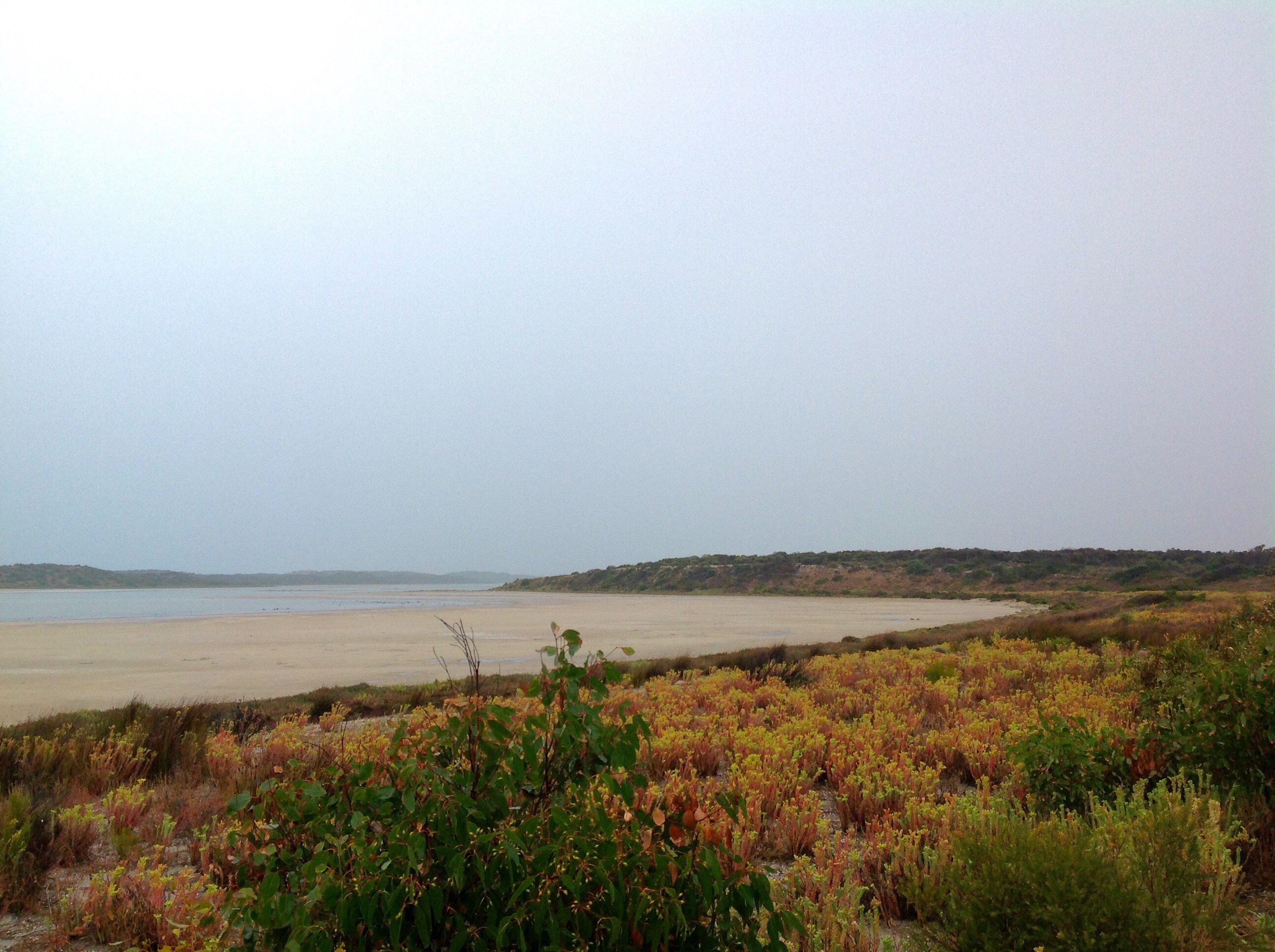
At the moment the sand flats alongside the lagoon at Hell’s Gate (Parnka Point) are slowly flooding. Large flocks of water birds are scurrying hither and thither across the shallow water, obviously feeding on whatever the water has brought to the surface.
The landscape is divided into horizontal shades of grey, with pale pinks, greens and browns in the hardy plants that curve around at the back of the sand flats. The water in the lagoons is a pale grey-green and the sand flats are a muddy grey. The dunes along the far side of the lagoon are only vaguely visible during the heaviest of the rain squalls. The sky is a luminous and uniform pale grey. There’s no hint of the sun at the moment other than the soft light in the clouds.
Yesterday was a marvelous sunny day and the weather should clear later. So right now we are sitting here, listening to music and taking the odd photo when the urge grabs us. It’s pretty wet but we are staying dry and filling buckets with good clean rainwater. This place is a fair distance from any large town, although there are some small villages not too far away which cater to the large farming operations around here.
I first visited the Coorong in 2009 and have wanted to return ever since then to spend a decent amount of time exploring this long stretch (130 kilometres) of the South Australian coast. We have a week here. We need a few more supplies so we will backtrack to Meningie then head down to Tea Tree crossing. When we get there we will check the conditions to see if we can get over onto the Younghusband Peninsula which forms the western border of the Coorong between the ocean and the lagoons. It is possible to drive on the beach all the way up this peninsula to the mouth of the Murray River where it ends its long journey from the Snowy Mountains to the sea.
(We camped at a few spots much further up the Murray River on our way from Victoria to South Australia and swam in it a few times, but the weather was a lot hotter then … over 40 degrees Celsius. The Murray and Darling Rivers are the heart of the third largest river system in the world after the Amazon and the Nile and in the past were heavily used by barges, paddle-steamers and other craft to carry goods to and from the interior. The Coorong itself is a series of lagoons stretching down the coast from the mouth of the Murray and filled from time to time when the Murray River floods. Farming up river has drastically reduced the amount of water flowing into the Corrong which has endangered this sensitive environment and habitat for many types of birds. Thankfully the management of the water levels in the Coorong has improved in recent years)
As we travel slowly south through the Coorong I’m hoping to get right in amongst the sand dunes and get some shots of some of the birds and hopefully some great sunrises and sunsets. The light yesterday evening was pretty good and the pale blue light after sunset was quite special. We have already seen several Emus, falcons, Black-shouldered Kites, Pelicans, and many different waders, cormorants, darters, avocets and other water birds.
I love this wild place. If you don’t know much about the Coorong then follow these links to learn more. Perfect for anyone who wants to find a peaceful corner that really feels remote and has great birdlife. The scenery grows on you and the longer you stay here the more you’ll see.
We have a week to get from Rhonda and Tina’s home in Tweed Heads on the northern border of New South Wales to Limeburners Creek near Newcastle where we are going to stay with Paul’s daughter Fiona and her husband Tony and their daughter Isla. We could drive down the Pacific Highway and be there in a day or two but as we like to avoid highways and find more interesting places to amble through we’ll need all the time we have available.
After finalising our chores in Tweed Heads we head straight inland to follow a back road through the hills to the pretty village of Tumbulgum on the wide and slowly flowing Tweed River and then down to Murwillimbah. The Information Centre in Murwillimbah has some great displays showing how the Tweed Valley was formed from a volcano. The massive volcano has left us a legacy of an outer caldera which includes Springbrook, Lamington, Border Ranges, Mount Jerusalem and Nightcap National Parks in Queensland and New South Wales and which extends to the easternmost point of mainland Australia at Byron Bay. The inner caldera surrounds the always impressive and usually cloud-shrouded Mount Warning, known to the Aboriginal inhabitants as Wollumbin, or Cloud Gatherer. It is not surprising that this remains a sacred spot for them. Rich volcanic soil between the two caldera supports many farms and pretty villages including Chillingham, Uki, and Tyalgum. On the western slopes much of the country includes the Wollumbin State Forest and Mebbin National Park. My decision to move north to live in this general area twelve years ago was made during annual holidays escaping a cold Adelaide winter to stay with Rhonda and Tina on their property just outside Tylagum. Much of my time was spent on their large deck looking out at the majesty of the ranges with excursions to visit many of the special spots in the valley and occasional trips to the beautiful coast forming the eastern border of the valley. No wonder this valley retains a special spot in my heart.
From Murwillimbah we drive to the base of Mount Warning and enjoy a late picnic in the national park before wandering along a short track through the rain forest. After passing through Uki we turn off the bitumen to take a dirt road which winds along the edge of Byrill Creek and into Mebbin National Park. A walk from the campground down to the creek promises some fig trees as a reward for descending the fairly steep path and they don’t disappoint. We had just planned a short stroll and weren’t expecting much so Paul has to make a second trip to get his tripod and additional lenses to capture some shots of these giants of the forest.
Mebbin National Park, Tweed Valley, NSW, Australia
Our morning drive is punctuated by stops for Paul to try to find the right angle to shoot Mount Warning and his regrets that during our time in Tweed Heads we hadn’t found the time to properly explore this area … but that could take a month or more so it will have to wait until another visit.
We are mainly planning to make our journey south along inland roads but along the way we are calling in to visit friends of Pauls at Minnie Waters on the coast east of Grafton. We take as many minor roads as possible avoiding major towns and highways whenever we can. We finish the day’s roundabout drive with a winding road leading past paperbark swamps in the Pine Brush State Forest and a fairly rough 4wd track over the top of the range in the Candole State Forest. At Minnie Waters we set up camp behind the general store which is owned by Paul’s friends, Emma and Stuart, and enjoy a bracing swim in the turbulent coastal waters.
Minnie Waters, NSW, Australia
The water is a little calmer for our morning swim and by the time we have had breakfast and morning coffee at our camp, coffee with Emma and then another swim it is almost lunchtime so we have another coffee and lunch before we go.
We continue our meandering route and head inland and up into the mountains arriving in Dorrigo via a delightful back road. After getting some up to date information on the state of the waterfalls further south we drive to the falls at Ebor for a quick look.
Ebor Falls, Waterfall Way, NSW, Australia
We’re keen to check out a camp site by the creek at the base of the New England National Park so we don’t linger and continue our drive. The campsite is not as pleasant as we thought and the camping ground in the national park is full so we head up to Point Lookout at the top of the park to check out the options. That sure doesn’t disappoint, the views are spectacular and the walks look very interesting. Paul wants both sunset and sunrise photos so, although there is no official campsite here, we make a late setup and early pack-up in the day visitor carpark. Another photographer has the same idea and spends the night in his campervan alongside us.
Point Lookout, New England National Park, NSW, Australia
Point Lookout is 60km from the coast but at 1,500m high Paul catches the sun emerging from the horizon well out to sea, a stunning view and well worth the early morning. After breakfast we decide on the Eagle’s Nest Track for our walk. It’s only 2 km long but the sign suggests it will take 2 hours. With our habit of stopping frequently to enjoy the views and take photos that means it will probably take us 3 hours.
The track drops steeply down and around the side of the mountain but formed steps make the walk relatively easy even if slow. Hanging mosses adorn many of the branches and further down we pass amongst gigantic Antarctic Beeches. Water trickles from the rocks creating vivid green gardens. The return walk is longer but gentler and we pass through snowgum woodland on the way back to the carpark.
Point Lookout, New England National Park, NSW, Australia
We decide the falls at Ebor are worth another look and after a stop at the trout hatchery to buy a smoked trout we return up the road to a pleasant free camping area alongside the river and opposite the national park entrance. Wildflowers are scattered amongst the grass and the babbling of the water in the creek more than makes up for the noise of the occasional truck or car passing by through the night. The trout made a delicious and easy pasta dinner to finish off another great day. Before dinner Paul makes a quick return trip along the road back to Dorrigo to take some photos along this very scenic drive.
Waterfall Way, near Dorrigo, NSW, Australia
Continuing our journey along the Waterfall Way we make a stop at Wollomombi Falls, one of the tallest waterfalls in Australia. It has been a very dry season and there is no water flowing at present but the view is still spectacular. If we are in the area after good rains it would certainly be well worth a return visit.
Our next stop is Bakers Creek Falls and although there is little water flowing over the falls the scenery is excellent. Paul decides the sunset light would be good at this gorge so although we are heading into Armidale for a lunch date we can return to this spot and spend the night here.
In Armidale we meet up with Terra, a Facebook friend of Pauls, who is completing the daunting task of walking around Australia on a ‘Lap for Lifeline’. The ‘lap’ is being done in sections, last year she completed the Perth to Darwin stretch, a massive feat. The next stretch from Darwin to Cairns and down the east coast will start again when the hot and wet season eases up and in the meantime she is filling in some sections down south. You can follow her progress on Facebook, The Happy Walk – Terra Lalirra, and Terra Lalirra (Vegan Athelete).
Meeting Facebook Friends, with Terra Lalirra in Armidale, NSW, Australia
We chat over a picnic lunch in the park for a couple of hours and after a couple of ‘selfies’ we turn back towards Bakers Creek Falls for the night. We have a little time to spare so we detour via Metz Gorge Lookout and the historic town of Hillgrove. The old school house at Hillgrove has been converted into a museum and by the time we have had a look around the town and museum it is time to return to Bakers Creek.
Bakers Creek Falls, Waterfall Way, NSW, Australia
We return to Armidale in the morning and then follow some side roads through rolling hills to Uralla. The old ivy covered chapel at Gostwyk is a great place for lunch, and photos, and from Uralla we turn onto Thunderbolts Way. This will take us right down to Gloucester, a mere 70km from our destination and we have two nights to spare so we relax and enjoy the scenery with a couple of short day’s drive and nights spent at Cobrabald River and right beside the river at Bretti Reserve.
Gostwyk Chapel, near Uralla, NSW, Australia
Gostwyk Chapel, near Uralla, NSW, Australia
Gostwyk Chapel, near Uralla, NSW, Australia
It is an easy drive next morning to Limeburners Creek just off Bucketts Way south of Gloucester. Fiona and Tony and their 2½ year old daughter Isla live on a 100 acre property surrounded by trees and totally off the grid with solar power, rain water and bottle gas supplemented by the wood stove for heating, hot water and cooking in winter. It is our base for the next six weeks over the Christmas and New Year period broken by a stay in Newcastle with Paul’s other daughter Caitlin and her partner Kevin and also stays in Sydney with his son Sean and with friends Greg and Helen.
According to the Bininj people of Kakadu there are six different seasons in the year and our visit is during Gurrung, the hot, dry season, which runs from late August until the beginning of October. In this season the amount of water in rivers, creeks, billabongs and waterfalls is decreasing and Mahbilil, the warm afternoon breeze, rises.
We enter Kakadu from the west along the Arnhem Highway and spend our first evening at Ubirr in the north-west of the park near the East Alligator River. We wander around the 1km track to see the Aboriginal rock art sites then climb to the top of the rock to enjoy the sunset over the Nadab floodplain. Most of the water on the plain has dried out but the colours of the grass and trees are still vibrant and lush. Smoke from late season burning make the sky hazy as the sun sinks.
Ubirr Lookout, Kakadu NP, NT
After spending the night at the nearby Merl campground our next week is spent in Arnhem Land on the Cobourg Peninsula in Garig Gunak Barlu National Park. (Take a look at The Land and Deepwater of the Garig Peoples for more about our time here.)
On our return we spend a few days in the town of Jabiru while they hold their annual Mahbilil Festival and Gurrung Sports Carnival. It’s lots of fun and we particularly enjoy tasting the magpie goose cooked over the hot coals of a long wood fire, watching the grand final of the AFL match and listening to some great music in the evening. The festival feels very casual and everyone is good-natured with lots of kids (face painting applied) dancing in the sand that has been spread across the grass in front of the stage. Paul visits the medical centre to have some sutures removed which takes no more than 30 minutes while Julie visits the local supermarket. We both enjoy the swimming pool at the caravan park during the middle of the day and our time here is refreshing and relaxing before we head out into the southern part of Kakadu.
We pick up some great tips on lesser visited spots and current conditions of waterfalls and swimming spots from rangers at the festival and the visitor centre and make our plans accordingly. Nourlangie is not far south down the Kakadu Highway and it offers some more Aboriginal art sites and the nearby Anbangbang billabong. There are several camping areas nearby but based on the ranger’s advice we decide to try Sandy Billabong for a couple of nights with a visit to Nourlangie and Anbangbang from there. A fire burning in the area means we spend the night at the campground at nearby Muirella Park instead but Paul captures the eerie feeling at Sandy Billabong in some photos and has written about the experience in the post Fiery Billabong. Because of the fire and the heat we move on after one night and continue south after our walk around Nourlangie.
Nourlangie, Kakadu NP, NT
We have decided to skip a visit to Jim Jim and Twin Falls this trip as the creeks and falls have stopped flowing but there are a few spots further south which still offer waterfalls and good swimming. Along the way we call into the Warradjan Aboriginal Cultural Centre at Cooinda. It offers a really interesting display with loads of well-presented information and we spend an hour or so wandering through reading and observing it all.
Moving on we reach the turn to Maguk and Barramundi Creek and take the 10km dirt road to the camping area. It is late afternoon by now so we leave our visit to the falls and pool for the next day and set up camp in a shady spot. The weather is really warming up now and when Mahbilil blows it comes off the sun-baked rocks and doesn’t provide any relief. We’re really looking forward to a swim when we set off for the waterfall in the morning. It’s a one kilometre walk through a monsoon forest and along a rocky creek to the small falls and the clear pool, but that’s based on a start from the day visitor area and we find out that the camping area is about one and a half kilometres from there so our two kilometre return walk turns into a five kilometre walk. Still it’s flat and not too far so it is good to get a bit more exercise. The swimming is fabulous and we spend quite a bit of time swimming across the pool to the falls and back and sitting in the sun on the rocks. Paul makes a return visit at sunset but this time he drives to the day visitor area to shorten the walk.
Maguk, Kakadu NP, NT
We managed to pick up a hitch hiker while we were in Maguk. A rustling noise during the night proves to be coming from inside the camper rather than from animals feeding outside. A pesky mouse has found his way in. His correct name is “Kakadu Dunnart” but when he proves to be able to set off mouse traps without being caught and continues to rustle away through a couple of nights Julie dubs him Mongrel Mouse while Paul reckons Mighty Mouse is far more fitting. Maybe the different attitudes are because Julie wakes at the slightest rustle while Paul slumbers on, until poked in the ribs by Julie. “MM” is still along for the ride when we leave Maguk after a two nights stay but either he disliked the corrugations and escaped or maybe he was just along for the ride to Gunlom because he leaves of his own accord shortly after we arrive
Mighty/Mongrel Mouse, Maguk to Gunlom, Kakadu NP, NT
Gunlom is another great spot with a beautiful pool and waterfall. It’s much busier than Maguk and there is less shade but it has the extra advantages of having a very short walk between the camping area and the plunge pool plus a series of pools at the top of a short but steep 20 minute walk up the escarpment. We are staying three nights so we use what shade we can find and also set up an awning across the back of the camper and shade cloth and a small awning over the kitchen. This really helps us keep cool and of course a short walk down to the plunge pool or a quick cold shower does the trick as well. The views from the top are inspiring and, as well as a prolonged excursion to explore and swim one day, Paul makes the trek before sunrise to capture the early light one day and stays up at the top of the waterfall until after dark another time.
Gunlom, Kakadu NP, NT
One of the really special spots recommended by the ranger at the festival is Jarrangbarnmi (Koolpin Gorge). A permit and a key to a gate are needed to visit the place and we arranged the permit before we left Jabiru and picked up the key before we came into Gunlom. The track in is 4WD only so although we only have 30km to drive from Gunlom it is a slow trip and we arrive at the camping area near Koolpin Creek at lunchtime. There is a large pool here but unfortunately it is definitely not an option for a swim to cool off as crocs are often around. We are going to have to work for our swims here. The gorge contains a series of pools we can walk to, and while Long Pool by the campground and the next pool, Vegetation Pool, are not safe for swimming the ones further up the creek are OK.
In fact they are far more than OK as we discover when we set out later in the afternoon. The first part of the walk to the upper pools is marked but when the markers run out it is a matter of finding your own path up and over and around the rocks. We make a couple of false starts but eventually work out a route past the obstacles. The next pool is Pink Pool, obviously named for the pink rocks at the far end. It is OK to swim here but we’ve been told it is even better further up so we clamber up and over some more rocks to another level and we reach Black Pool. Here we are surrounded by dark rocks and at this time of the day the pool is in deep shadow and has very dark, almost black water. The water is clear and fabulous although a bit on the chilly side but that’s welcome after our trek in the heat. On the rocks above this pool we see a few people taking in the late afternoon sun. They have reached Blue Pool and we’ll get there too, but not today, we’re happy spending a couple of hours here before returning to camp.
Black Pool, Jarrangbarnmi, Kakadu NP, NT
Next morning we set out with food and water included in our backpacks. Rather they are in Julie’s backpack as Paul’s is full of camera, lenses and filters and he has his tripod to carry as well. We reach Black Pool mid-morning and spend another couple of hours swimming, taking photos and reading. We’re now ready to tackle the climb up to Blue Pool. The direct route is not an option, unless we can climb sheer cliff walls that is. Instead we need to trek up the side of the hill to a sloped rock face we can use to reach a ridge. Once past the hump of the hill we need to descend down the steep hill to the pool. There are enough “steps” on the rocks to make it safely down and after about twenty minutes we are taking another welcome dip. It is not obvious how this pool got its name as the surrounding vegetation would make Green Pool seem more appropriate but perhaps that name is taken on another pool further up the valley. The water here is not as deep but it is certainly still very refreshing.
On our way back to Black Pool we take the time to admire the breath-taking views over the surrounding country. (Maybe the climb contributed to the breath-taking bit but it’s a good excuse for stopping.) Another swim and more photos are in order before we start to make our way back down to camp. This section of the walk seemed pretty tricky on our first walk in but it’s getting simpler all the time.
Breath Taking View, Jarrangbarnmi, Kakadu NP, NT
Our final day feels even hotter, it must be in the low 40’s by now and as the wind blows around the rocky bowl of hills it feels even hotter. We have plenty of water so a shower from the shower bag hung in the tree is a welcome activity. We had planned to take another trip to Black Pool mid-afternoon but the heat defeats us and we settle for another shower instead. We’ll definitely be back to this jewel but next time we’ll aim for earlier in the year when the weather is a little kinder.
We’ve heard people refer to Kakadu as Kakadon’t, but we really struggle to understand that sentiment as this is a very special place with lots of wonders to be found. Perhaps they don’t leave the bitumen and aren’t prepared to walk more than a short distance but a 4WD opens up lots more options and a little effort is well rewarded.


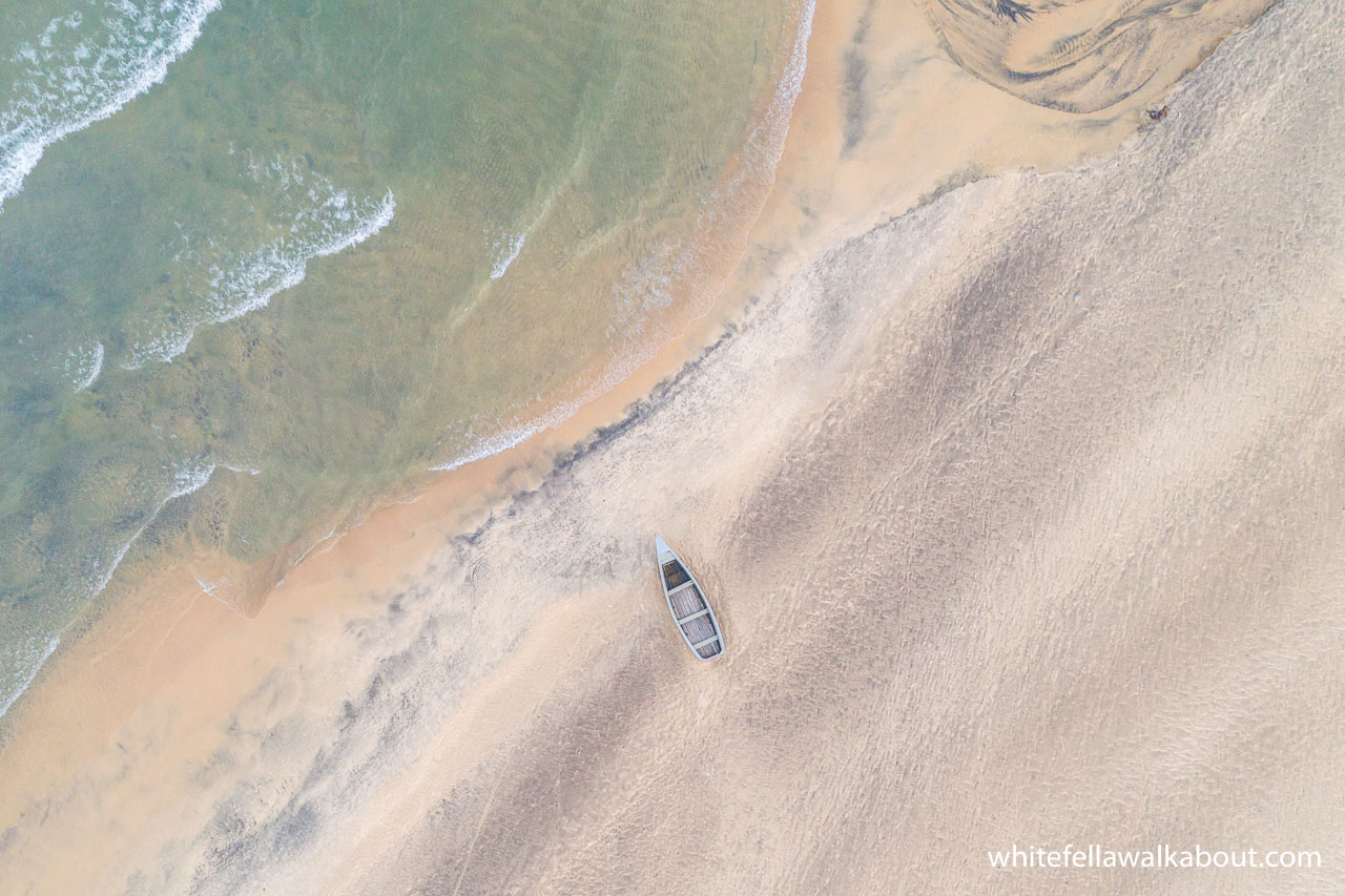


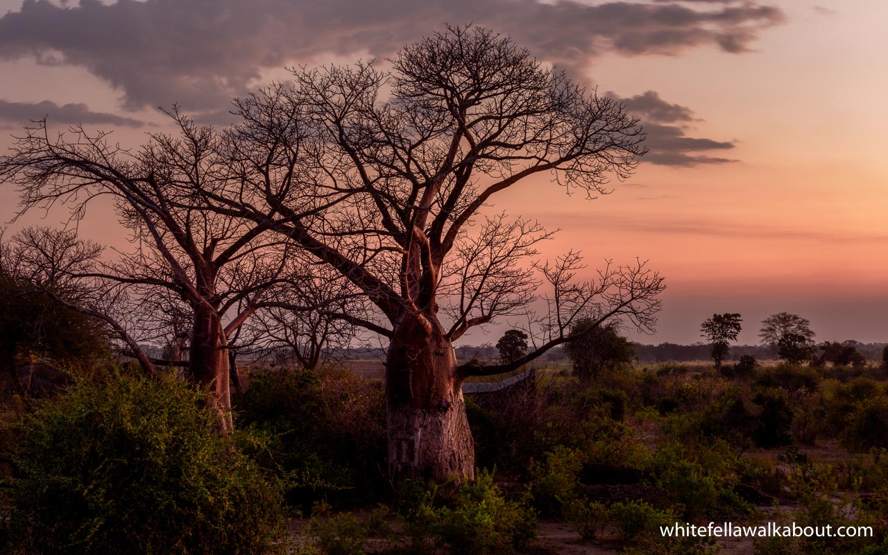


 While we were there we met a couple from Columbia in a Landcruiser doing a loop from Nairobi down through Zambia to Namibia then back up through Malawi and Tanzania to Nairobi again. They are avid bird watchers and we exchanged notes on where we planned to go in Zambia.